Close-range drone photos of roofs, facades, towers, and other hard-to-reach areas — high-resolution images for condition checks, maintenance planning, insurance records, and capital planning. ARC Digital Site captures the photos; your team decides how to use them.
Who uses this: property managers, roofing contractors, facility owners, and insurance professionals who need clear images of places that are dangerous or impossible to inspect from the ground.
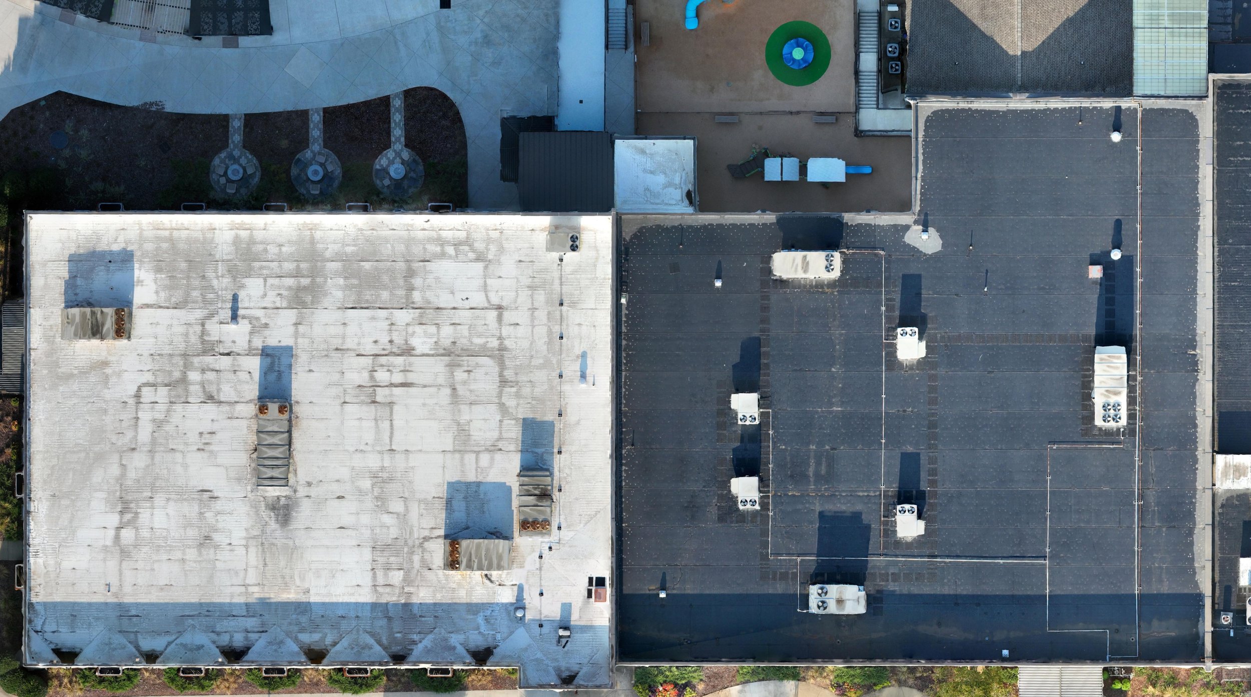
What you get: high-resolution close-range aerial photos of the areas you specify. Shots show surface condition, material wear, flashing, drainage, and other details. Images are labeled by building face or roof section and delivered digitally.
How we work: we confirm what you need, plan flight paths, then fly close passes to capture overlapping high-res images. Processed files are delivered in a few business days and organized for quick reference.
Recurring needs: we can set up scheduled flights to build a visual history (for example, annual roof records).
Safety and compliance: all flights follow FAA Part 107 rules. The Remote Pilot in Command manages flight safety and may change or delay work for weather, airspace, or site conditions.